Module 1 Action Items for BOWKER CREEK Survey # 115
| Stream Name | Survey Date | Organization | Project Name | Survey ID | Data Entered By |
| BOWKER CREEK | 2021-08-22 | Friends of Bowker Creek | Friends of Bowker Cr | 115 | Ciaran |
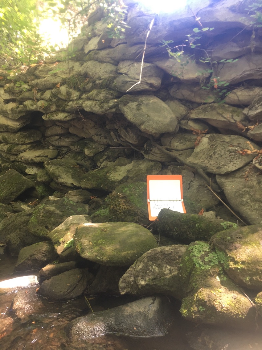 |
ID 1611 |
Feature # 1 |
From Last 0 |
Type Modification-Other |
Size 13.47m long/ 1.8m deep |
Bank Right |
Adjacent Land Use Undisturbed |
| Description: Wall of concrete filled sand bags |
|||||||
| Action Items: Wall is severely eroding. Wall needs to be replaced. |
|||||||
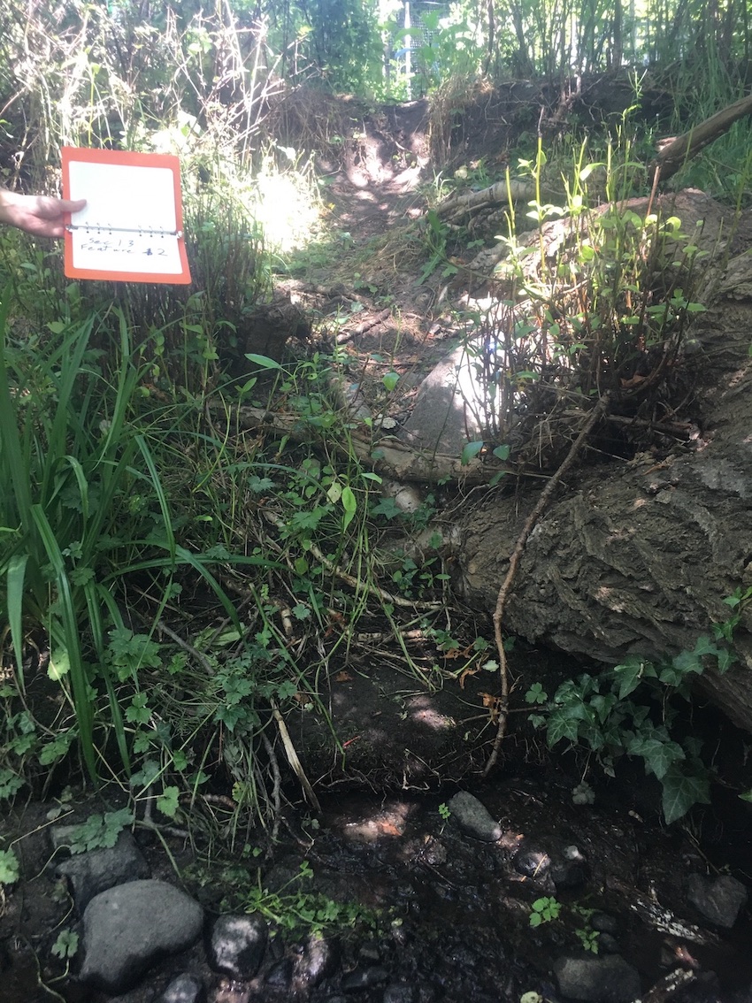 |
ID 1612 |
Feature # 2 |
From Last 11.07 |
Type Bank Erosion |
Size (H)1.7m, (W)3.1m, (L),7.1m (S)54.8% |
Bank Left |
Adjacent Land Use Undisturbed |
| Description: |
|||||||
| Action Items: No data collected |
|||||||
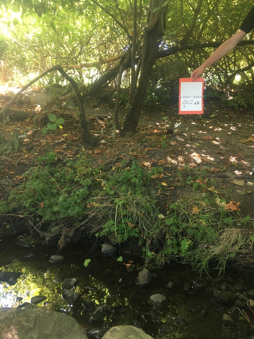 |
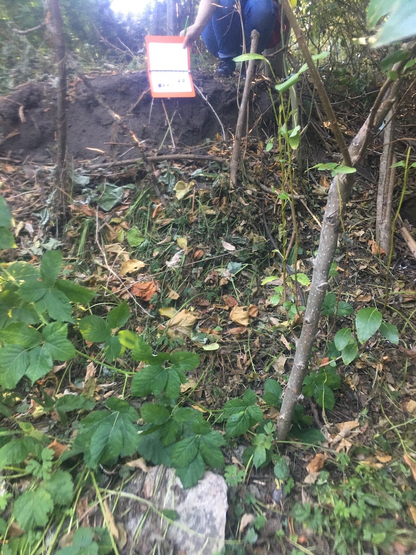
ID 1613 |
Feature # 3 |
From Last 3 |
Type Bank Erosion |
Size (H)1.6m, (L) 30m, (W) 3.6m (S) 44% |
Bank Right |
Adjacent Land Use Undisturbed |
| Description: |
|||||||
| Action Items: Adjacent land use: Riparian restoration area. rnSome erosion has been caused by human activity. Reinstate eroded slope |
|||||||
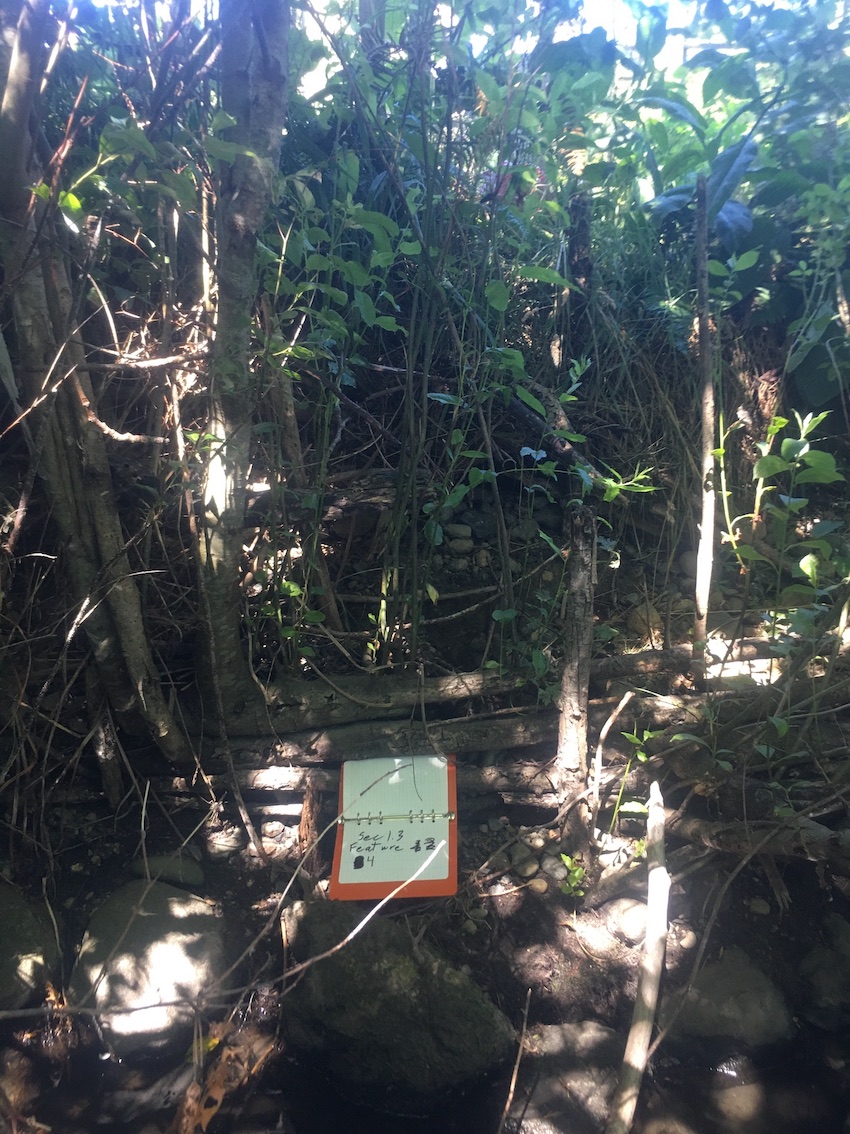 |
ID 1614 |
Feature # 4 |
From Last 2.4 |
Type Bank Erosion |
Size (H)1.4m, (W)1.1m, (L)13.27m (S)127% |
Bank Left |
Adjacent Land Use Undisturbed |
| Description: |
|||||||
| Action Items: Previous bio-engineering of woven willow tree has partly failed. Adjacent land use: Agriculture |
|||||||
 |
ID 1615 |
Feature # 5 |
From Last 0 |
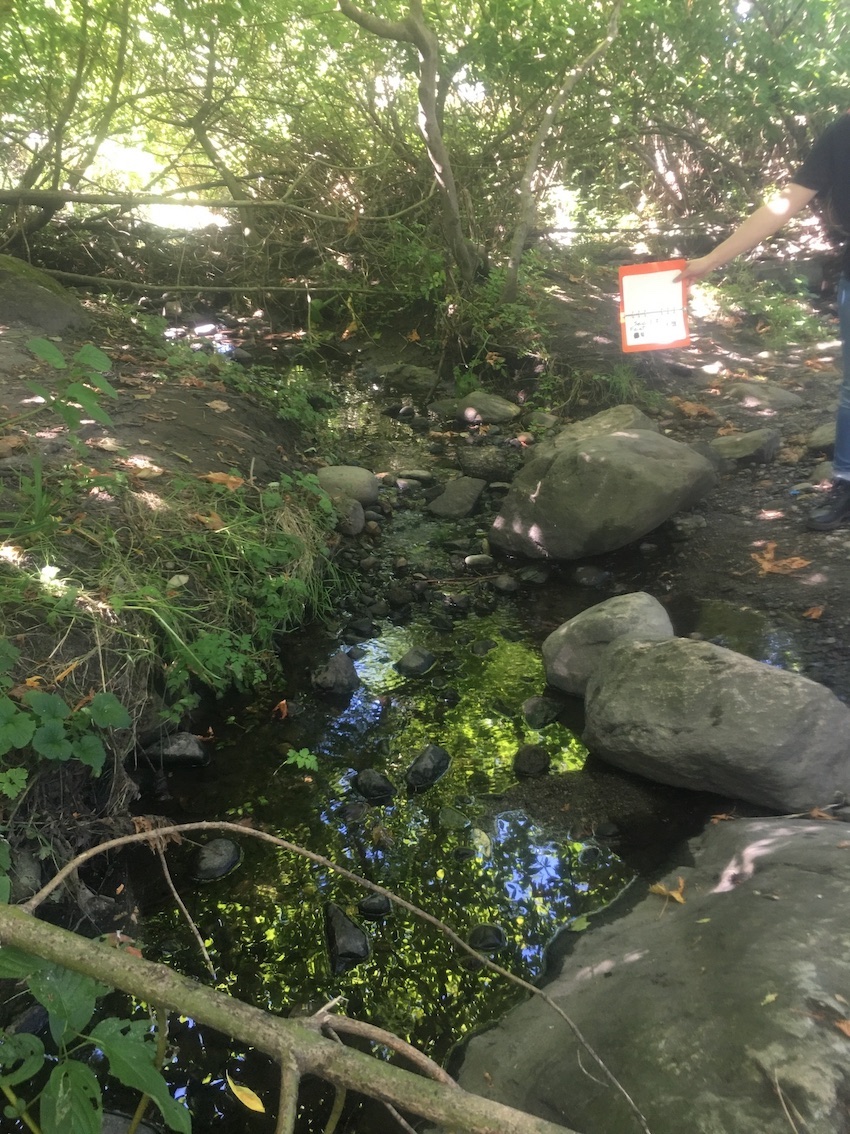
Type SIDE CHANNEL |
Size 15.57 |
Bank Right |
Adjacent Land Use Undisturbed |
| Description: Formed by a small island in the streamrn |
|||||||
| Action Items: Bankfull width 1.5mrnrnWetted 1m |
|||||||
 |
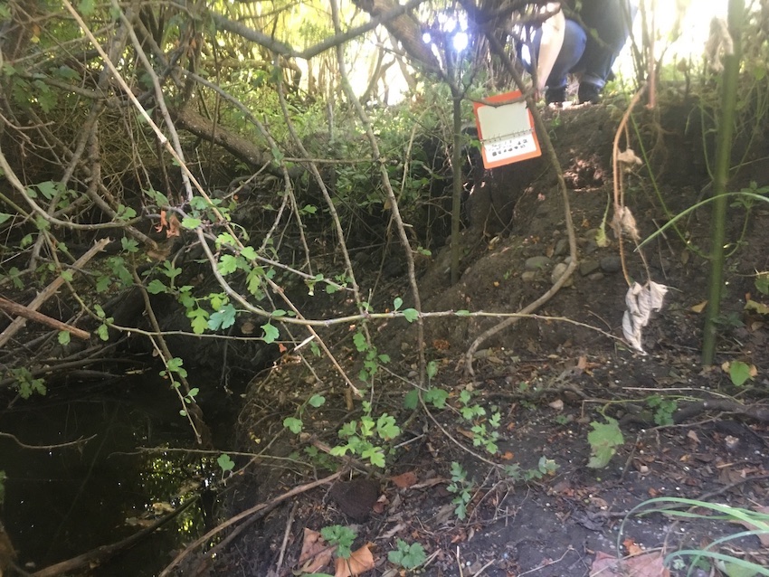
ID 1616 |
Feature # 6 |
From Last 22.4 |
Type Bank Erosion |
Size |
Bank Right |
Adjacent Land Use Undisturbed |
| Description: Severe erosion below culvert outlet.rnLength 13.7 m, Height 1.5 m, width 1.8 m, slope 83% |
|||||||
| Action Items: |
|||||||
 |
ID 1617 |
Feature # 7 |
From Last 0 |
Type Bank Erosion |
Size |
Bank Left |
Adjacent Land Use Undisturbed |
| Description: Large metal items embedded in streambedrnLength 13.7 m (Same as 6) |
|||||||
| Action Items: Water heater tank automobile axle, oil drum |
|||||||
 |
ID 1618 |
Feature # 8 |
From Last 0 |
Type Bank Erosion |
Size |
Bank Right |
Adjacent Land Use Undisturbed |
| Description: Enhancement. Native trees growing stakes in eroded zone. |
|||||||
| Action Items: |
|||||||
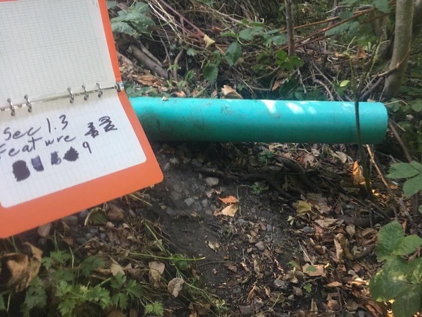 |
ID 1619 |
Feature # 9 |
From Last 7 |
Type Discharge Pipe-Storm Drain |
Size |
Bank Right |
Adjacent Land Use Parks |
| Description: 6" diameterrnDrop to substrate 0.23 |
|||||||
| Action Items: Recent bank erosion exposedrn1m of pipe |
|||||||
 |
ID 1620 |
Feature # 10 |
From Last 1.2 above feature 6 |
Type Bank Erosion |
Size |
Bank Left |
Adjacent Land Use Undisturbed |
| Description: Severe erosion below culvert outlet.rn(L) 12.5m, (H) 1.4m, (W)1.1m, slope 127% |
|||||||
| Action Items: |
|||||||
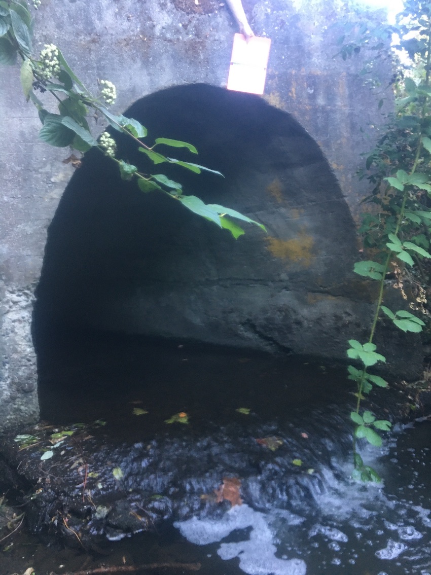 |
ID 1621 |
Feature # 11 |
From Last 12.5 |
Type Discharge Pipe-Storm Drain |
Size |
Bank Right |
Adjacent Land Use Parks |
| Description: CulvertrnHeight of lip above substrate 0.54m. Depth of water 0.51m. (3cm drop). Length-2 city blocks. width-1.83m. Height-1.79m. |
|||||||
| Action Items: Wall is severely eroding. Wall needs to be replaced. |
|||||||
|
|
ID 1622 |
Feature # 12 |
From Last |
Type Bank Erosion |
Size |
Bank Left |
Adjacent Land Use Undisturbed |
| Description: |
|||||||
| Action Items: |
|||||||
Records 1 to 12 of 12