| Observation Number |
Feature Number |
Photo Taken |
Photo |
Upstream from last feature |
Feature Description |
Feature Detail |
Feature Size |
Bank Affected |
Adjacent Land Use |
Action Items |
| 1296 |
1 |
No |
 |
6.9 |
SIDE CHANNEL |
This channel is fed from the mainstem 31.5 metres upstream width is 1.5 metres slow flow |
|
Left |
Parks |
|
| 1297 |
2 |
No |
|
31.5 |
SIDE CHANNEL |
here is the upstream end of feature one |
|
Left |
Parks |
|
| 1298 |
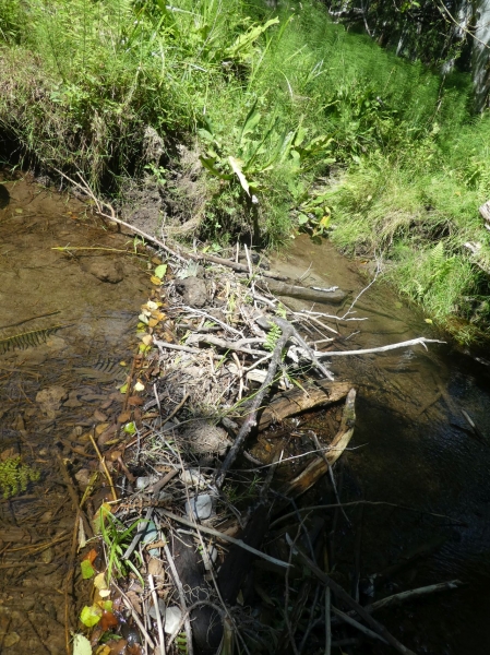
3 |
No |
 |
18.9 |
Obstruction-Beaver Dam |
approx 10cm in height and bank to bank |
|
Across |
Parks |
watch to see if this is active build site |
| 1299 |
4 |
Yes |
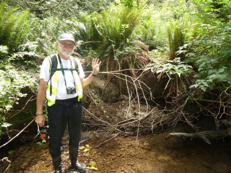 |
127.5 |
Bank Erosion |
slumping bank |
|
Right |
Parks |
seam of gravel at the bottom will add substrate as it erodes |
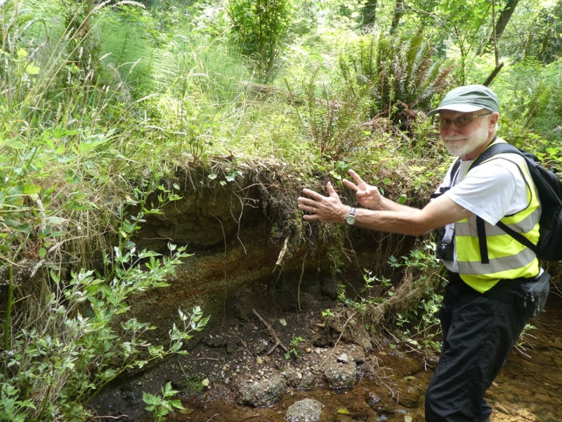
| 1300 |
5 |
Yes |
 |
18.9 |
Bank Erosion |
slump approx 2 metres in length - no human infrastructure in sight. Gravel seam at creek level |
|
Right |
Undisturbed |
watch this one to see if creek movement happens |
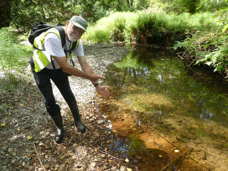
| 1301 |
6 |
Yes |
 |
11 |
WATERBODY-Tributary, wetland, ditch, other |
iron oxcide |
|
Right |
Undisturbed |
groundwater influence? |
| 1302 |
7 |
Yes |
 |
30.5 |
Bank Erosion |
slump approx 3 m in Length gravel seam |
|
Right |
Undisturbed |
|
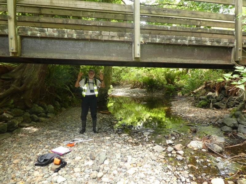
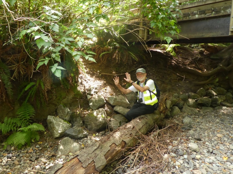
| 1303 |
8 |
Yes |
 |
64 |
Modification-Bridge |
"horse" bridge L = 0.55 mrnW= 12mrnwater to bottom of structure is 1.9mrn |
|
Across |
Parks |
riprap footing start downstream of this bridge and extend upstream |
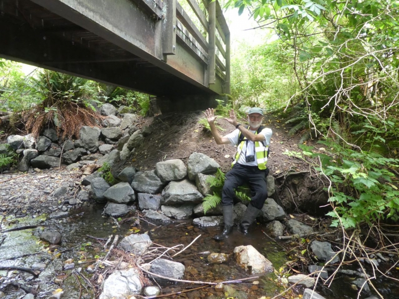
| 1304 |
9 |
Yes |
 |
1.9 |
Modification-Rip-rap |
measurement is 1.9 m d/s of foot bridge l= 8m riprap is <0.5 m in size |
|
Right |
Parks |
"trail" is causing rip rap to fall into creek |
| 1305 |
10 |
Yes |
 |
0.5 |
Modification-Rip-rap |
L = 8.6 m riprap is > 0/5 m in size |
|
Left |
Parks |
"trail" is causing rip rap to fall into water and landscape cloth is now exposed |