 |
ID
1507 |
Feature #
1 |
From Last
0 |
Type
Modification-Other |
Size
|
Bank
Left |
Adjacent Land Use
Residential |
Description:
rock wall, vertical, 1.6 m hi, 141m long |
Action Items:
lack of riparian vegetation |
|
 |
ID
1508 |
Feature #
2 |
From Last
0 |
Type
Modification-Other |
Size
|
Bank
Left |
Adjacent Land Use
Residential |
Description:
rock wall, vertical, 1.6 m high, 141m long |
Action Items:
lack of riparian vegetation |
|
 |
ID
1509 |
Feature #
3 |
From Last
1.1 |
Type
Discharge Pipe-Storm Drain |
Size
|
Bank
Right |
Adjacent Land Use
Parks |
Description:
.6m from substrate, 15 cm diameter |
Action Items:
|
|
 |
ID
1510 |
Feature #
4 |
From Last
8.2 |
Type
Discharge Pipe-Tile Drain |
Size
|
Bank
Right |
Adjacent Land Use
Parks |
Description:
drain tile, 10 cm diameter, 1.3m drop from substrate |
Action Items:
|
|
 |
ID
1511 |
Feature #
5 |
From Last
11.8 |
Type
Discharge Pipe-Tile Drain |
Size
|
Bank
Right |
Adjacent Land Use
Parks |
Description:
drain tile, 10 cm, 1.45m drop to substrate |
Action Items:
|
|
 |
ID
1512 |
Feature #
6 |
From Last
4.8 |
Type
Discharge Pipe-Tile Drain |
Size
|
Bank
Right |
Adjacent Land Use
Parks |
Description:
10 cm, 1.45 drop to substrate |
Action Items:
|
|
 |
ID
1513 |
Feature #
7 |
From Last
4.6 |
Type
Discharge Pipe-Tile Drain |
Size
|
Bank
Right |
Adjacent Land Use
Parks |
Description:
drain tile, 10 cm, 1.15 m above substrate |
Action Items:
|
|
 |
ID
1514 |
Feature #
8 |
From Last
|
Type
Discharge Pipe-Tile Drain |
Size
|
Bank
Right |
Adjacent Land Use
Parks |
Description:
drain tile, 10 cm, 1.4 m from substrate |
Action Items:
|
|
 |
ID
1515 |
Feature #
9 |
From Last
10.8 |
Type
Modification-Culvert |
Size
|
Bank
Across |
Adjacent Land Use
Residential |
Description:
culvert under hampshire road 2.1 m high, 3.2 m wide, 1 cm water depth, rn20 degree C 2 metres downstream, 15.4m long |
Action Items:
land use: residential on left and park on right; 20 degreeC at 2 metres upstream, all concrete substrate downstream from culvert/ all boulder and cob |
|
 |
ID
1516 |
Feature #
10 |
From Last
.5m |
Type
Discharge Pipe-Storm Drain |
Size
|
Bank
Both |
Adjacent Land Use
Residential |
Description:
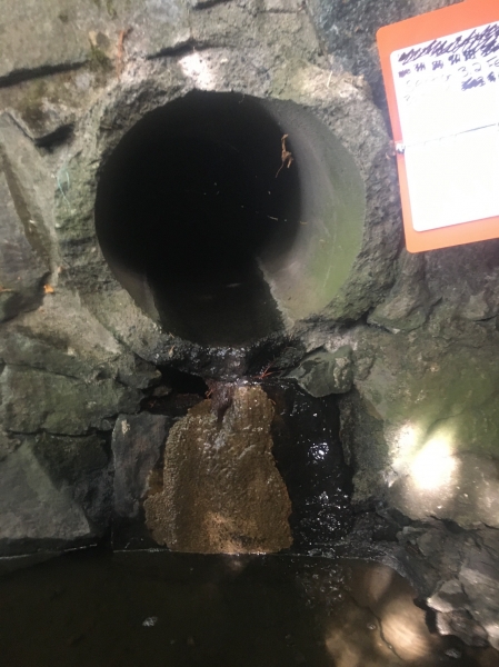
2 storm drains, 20 cm diameter, .9m drop to substraternNo flow. |
Action Items:
land use is both park on right and residential on right |
|
 |
ID
1517 |
Feature #
11 |
From Last
14.7m |
Type
Discharge Pipe-Storm Drain |
Size
|
Bank
Both |
Adjacent Land Use
Parks |
Description:
2 storm drains; 25 cm diameter on right bank; 40 cm on leftrnboth residential on left park on right; rn |
Action Items:
slight flow of clear water |
|
 |
ID
1518 |
Feature #
12 |
From Last
4m |
Type
Discharge Pipe-Storm Drain |
Size
|
Bank
Both |
Adjacent Land Use
Parks |
Description:
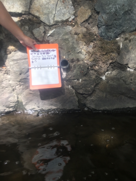
2 storm drains; .45 m above substrate; |
Action Items:
no flow 5cm diameter |
|
 |
ID
1519 |
Feature #
13 |
From Last
2.2 |
Type
Discharge Pipe-Storm Drain |
Size
|
Bank
Left |
Adjacent Land Use
Parks |
Description:
.45m above substrate |
Action Items:
no flow 5 cm diameter |
|
 |
ID
1520 |
Feature #
14 |
From Last
1.8 |
Type
Discharge Pipe-Storm Drain |
Size
|
Bank
Left |
Adjacent Land Use
Parks |
Description:
|
Action Items:
|
|
 |
ID
1521 |
Feature #
15 |
From Last
2.4 |
Type
Discharge Pipe-Storm Drain |
Size
|
Bank
Both |
Adjacent Land Use
Parks |
Description:
2 storm drains; but on both banks |
Action Items:
notes use ditto marks to repeat description for features 10 through 20 |
|
 |
ID
1522 |
Feature #
16 |
From Last
4.8 |
Type
Discharge Pipe-Storm Drain |
Size
|
Bank
Both |
Adjacent Land Use
Parks |
Description:
2 storm drains, 25cm diameter on right bank, 40 cm on left bank |
Action Items:
upstream of culvert no longer concrete. the creek bed now boulder and cobble |
|
 |
ID
1523 |
Feature #
16 |
From Last
4.8 |
Type
Discharge Pipe-Storm Drain |
Size
|
Bank
Both |
Adjacent Land Use
Parks |
Description:
2 storm drains, 25cm diameter on right bank, 40 cm on left bank |
Action Items:
|
|
 |
ID
1524 |
Feature #
17 |
From Last
3.1 |
Type
Discharge Pipe-Storm Drain |
Size
|
Bank
Both |
Adjacent Land Use
Undisturbed |
Description:
storm drain, .45m above substrate, no flow, 5 cm diameter |
Action Items:
|
|
 |
ID
1525 |
Feature #
18 |
From Last
3.9 |
Type
Bank Erosion |
Size
|
Bank
Both |
Adjacent Land Use
Parks |
Description:
storm drain, .45m above substrate, no flow, 5 cm diameter |
Action Items:
|
|
 |
ID
1526 |
Feature #
19 |
From Last
1.8 |
Type
Discharge Pipe-Storm Drain |
Size
|
Bank
Right |
Adjacent Land Use
Parks |
Description:
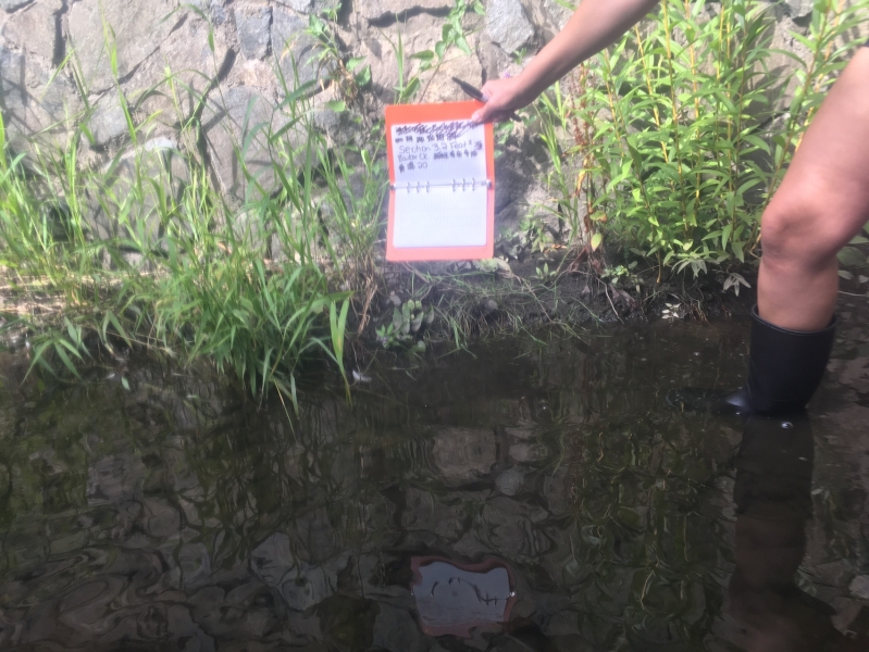
10 cm storm drain, 1.6m drop to substrate, no flow |
Action Items:
|
|
 |
ID
1527 |
Feature #
20 |
From Last
0 |
Type
Modification-Other |
Size
|
Bank
Left |
Adjacent Land Use
Parks |
Description:
Emergent mudbank, 4.3 m long, .4m wide, with non/native |
Action Items:
could replant with native plants (remove golden willow, reed canary grass) |
|
 |
ID
1528 |
Feature #
21 |
From Last
4.1 |
Type
Discharge Pipe-Storm Drain |
Size
|
Bank
Both |
Adjacent Land Use
Parks |
Description:
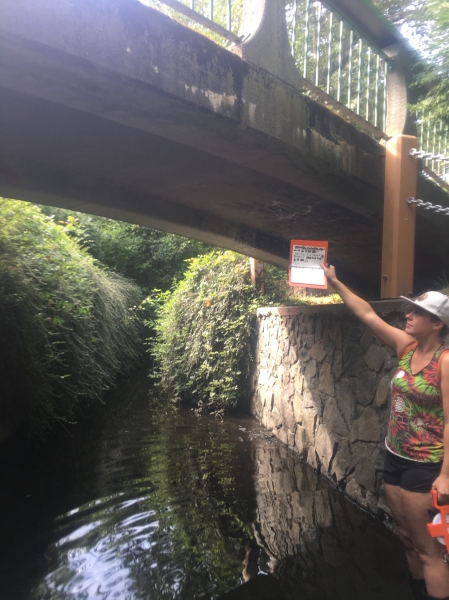
2 storm drains, 5cm diameter, no flow, .45m from substrate |
Action Items:
|
|
 |
ID
1529 |
Feature #
22 |
From Last
22 |
Type
Obstruction-Bridge |
Size
|
Bank
Across |
Adjacent Land Use
Parks |
Description:
foot bridge, height from substrate 3.7 m, 3m width, 3.2 length, 2.3 meter water depth |
Action Items:
|
|
 |
ID
1530 |
Feature #
23 |
From Last
0 |
Type
Discharge Pipe-Storm Drain |
Size
|
Bank
Both |
Adjacent Land Use
Parks |
Description:
2 storm drains, 5cm diameter, .45m from substrate |
Action Items:
|
|
 |
ID
1531 |
Feature #
24 |
From Last
10.7m |
Type
Discharge Pipe-Storm Drain |
Size
|
Bank
Both |
Adjacent Land Use
Parks |
Description:
|
Action Items:
|
|
 |
ID
1532 |
Feature #
25 |
From Last
0 |
Type
Discharge Pipe-Storm Drain |
Size
|
Bank
Left |
Adjacent Land Use
Parks |
Description:
Emergent mudbank with non-native invasive, 3m long, .6m out from wall |
Action Items:
|
|
 |
ID
1533 |
Feature #
26 |
From Last
4.8m |
Type
Discharge Pipe-Storm Drain |
Size
|
Bank
Both |
Adjacent Land Use
Parks |
Description:
pair of 5cm storm drains, .45m from substrate |
Action Items:
|
|
 |
ID
1534 |
Feature #
27 |
From Last
4.5 |
Type
Discharge Pipe-Storm Drain |
Size
|
Bank
Both |
Adjacent Land Use
Parks |
Description:
pair of 5cm storm drains, .45m from substrate |
Action Items:
|
|
 |
ID
1535 |
Feature #
28 |
From Last
4.2 |
Type
Bank Erosion |
Size
|
Bank
Both |
Adjacent Land Use
Parks |
Description:
pair of 5cm storm drains, .45m from substrate |
Action Items:
|
|
 |
ID
1536 |
Feature #
29 |
From Last
1.6 |
Type
Discharge Pipe-Storm Drain |
Size
|
Bank
Right |
Adjacent Land Use
Parks |
Description:
pair of 5cm storm drains, .35m drop from substrate, no flow |
Action Items:
|
|
 |
ID
1537 |
Feature #
30 |
From Last
2.8 |
Type
Discharge Pipe-Storm Drain |
Size
|
Bank
Both |
Adjacent Land Use
Parks |
Description:
pair of 5cm storm drains, .45m from substrate |
Action Items:
|
|
 |
ID
1538 |
Feature #
31 |
From Last
2.5 |
Type
Discharge Pipe-Storm Drain |
Size
|
Bank
Both |
Adjacent Land Use
Parks |
Description:
2 storm drains, 5cm., .45m from substrate |
Action Items:
|
|
 |
ID
1539 |
Feature #
32 |
From Last
5.8 |
Type
Discharge Pipe-Storm Drain |
Size
|
Bank
Both |
Adjacent Land Use
Parks |
Description:
2 storm drains, 5cm., .45m from substrate |
Action Items:
|
|
 |
ID
1540 |
Feature #
33 |
From Last
|
Type
Discharge Pipe-Storm Drain |
Size
|
Bank
Both |
Adjacent Land Use
Parks |
Description:
2 storm drains, 5cm., .45m from substrate |
Action Items:
|
|
 |
ID
1541 |
Feature #
34 |
From Last
5.9 |
Type
Obstruction-Dam |
Size
|
Bank
Both |
Adjacent Land Use
Parks |
Description:
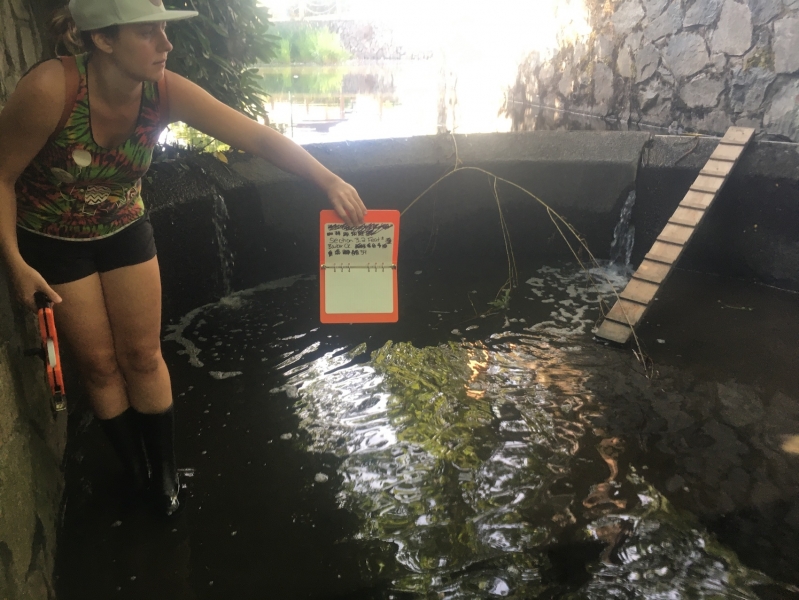
Dam concrete apron on either side about 3m downstream, with plunge pool .6m deep. Width 3.9m, .75m drop to water. No water coming over dam, all comin |
Action Items:
Most of flow not coming over dam, but coming through cracks and from under Rockwell downstream. Is the dam failing? Definite obstruction to fish pass |
|