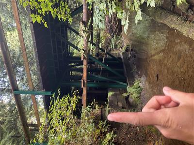
 |
ID
1737 |
Feature #
1 |
From Last
0 |
Type
Modification-Bridge |
Size
Length = 4m , width = 12.5m, height = 3.7m, depth |
Bank
Across |
Adjacent Land Use
Residential |
Description:
Vehicle bridge |
Action Items:
Sea Ranch Property - Light agricultural / residential |
|
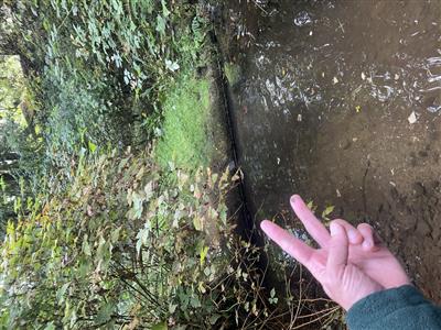 |
ID
1738 |
Feature #
2 |
From Last
17 |
Type
Enhancement-Log/Rock weir, Fishway |
Size
|
Bank
Across |
Adjacent Land Use
Residential |
Description:
Log weir on Tributary. Length = 35cm, width = 4.5m, height = 3cm, pool depth = 27cm. |
Action Items:
|
|
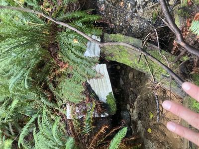 |
ID
1739 |
Feature #
3 |
From Last
155 |
Type
GARBAGE |
Size
|
Bank
Right |
Adjacent Land Use
Agriculture |
Description:
Garbage - metal roofing. 2 pieces. Area of approximatelyl 6 sq meters |
Action Items:
|
|
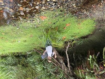 |
ID
1740 |
Feature #
4 |
From Last
225 |
Type
Bank Erosion |
Size
|
Bank
Right |
Adjacent Land Use
Agriculture |
Description:
Significant undercut/eroded bank - length = 10m, height = 2m |
Action Items:
inactive agriculture / hobby farm field |
|
 |
ID
1741 |
Feature #
5 |
From Last
300 |
Type
Modification-Bridge |
Size
|
Bank
Across |
Adjacent Land Use
Parks |
Description:
Footbridge.Width = 4.5m, Length - 3.5m, height = 60cm, depth of water = 3cm |
Action Items:
|
|
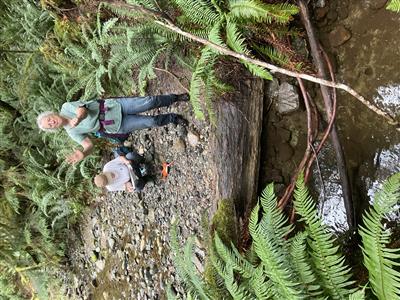 |
ID
1742 |
Feature #
6 |
From Last
94 |
Type
Obstruction-Falls, Cascade, Canyon |
Size
|
Bank
Across |
Adjacent Land Use
Undisturbed |
Description:
High step pool from LWD, dry cascade. Height = 1m, depth of pool at base = 35cm, width = 3m, length = 35cm. |
Action Items:
Dry upstream, seasonal obstruction to resident fish movement. Limited habitat for anadramous fish upstream, possible migration barrier. |
|
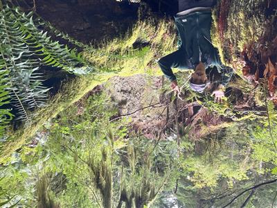 |
ID
1743 |
Feature #
7 |
From Last
60 |
Type
Bank Erosion |
Size
|
Bank
Left |
Adjacent Land Use
Undisturbed |
Description:
Slope 90 percent. Height 4m. Length 30m |
Action Items:
|
|
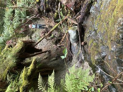 |
ID
1744 |
Feature #
8 |
From Last
1 |
Type
Obstruction-Falls, Cascade, Canyon |
Size
|
Bank
Across |
Adjacent Land Use
Undisturbed |
Description:
Bedrock cascade. Length 8m, 20 degree slope |
Action Items:
|
|
 |
ID
1745 |
Feature #
9 |
From Last
|
Type
Modification-Bridge |
Size
|
Bank
Across |
Adjacent Land Use
Undisturbed |
Description:
Foot bridge on lost lake trail. Length = 1m, width =12.4m, height =1m, depth of water = 1cm |
Action Items:
Survey end point location |
|


