 |
ID
904 |
Feature #
1 |
From Last
0 |
Type
Bank Erosion |
Size
see details |
Bank
Across |
Adjacent Land Use
Industrial |
Description:
at upstream end of CN tracks
17.5M across <--->
3M X 4 openings
1.3M HIGH from top of water to bottom of culvert |
Action Items:
These are filling up with small debris and mud
Heron in the area protecting nest
filter cloth at the top of bank - general clean up of area needed |
|
 |
ID
905 |
Feature #
2 |
From Last
16.5 |
Type
Bank Erosion |
Size
w= 0.80 H2O D = |
Bank
Right |
Adjacent Land Use
Parks |
Description:
TRENCH W-0.8MH20-0.05H20 3M LENGTH is wetted then water goes subsurface, |
Action Items:
Human made trench
(hobo camp for one person here) one very skinny fish in the wetted area
Invasive removals needed Blackberry , holly, bittersweet, |
|
 |
ID
906 |
Feature #
3 |
From Last
29 |
Type
Bank Erosion |
Size
|
Bank
Both |
Adjacent Land Use
Parks |
Description:
DEBRIS UNIFORM CUTS.PICTURES ONLY.no measurements taken
|
Action Items:
(AT 9M U/S FILTER CLOTH CAN BE REMOVED.) this debris will make it's way into the culverts under the train tracks |
|
 |
ID
907 |
Feature #
4 |
From Last
10.5 |
Type
Enhancement-Boulder Cluster |
Size
1 meter of rocks and a log |
Bank
Left |
Adjacent Land Use
Parks |
Description:
small rock groin with log |
Action Items:
treated knotweed in this area * regrowth occurring buttercups and morning glory
**good place to plant once invasives are gone** |
|
 |
ID
908 |
Feature #
5 |
From Last
1.0 |
Type
Modification-Culvert |
Size
0.71 wide, 0.65 high with 0.15cm of water depth |
Bank
Right |
Adjacent Land Use
Parks |
Description:
concrete pipe |
Action Items:
fish in area |
|
 |
ID
909 |
Feature #
6 |
From Last
10.9 |
Type
Modification-Bridge |
Size
WIDTH 14M X LENGTH 19.7 |
Bank
Both |
Adjacent Land Use
Parks |
Description:
SHALLOWEST point under BRIDGE 1.1M HIGH |
Action Items:
There is beaver activity here! and someone has been putting debris on the right bank d/s end of bridge. The water is running along the left bank **** |
|
 |
ID
910 |
Feature #
7 |
From Last
19.7 |
Type
Bank Erosion |
Size
9.25M IN LENGTH |
Bank
Left |
Adjacent Land Use
Parks |
Description:
|
Action Items:
LOOKS LIKE PEOPLE HAVE BEEN WORKING HERE. TREES DOWN. MUD BANK. Beaver as well.Water is backing up from debris under the bridge - it is unnaturally |
|
 |
ID
911 |
Feature #
8 |
From Last
17 |
Type
Modification-Other |
Size
WIDTH 0.8M |
Bank
Left |
Adjacent Land Use
Parks |
Description:
TRENCHWATER GOES IN 2M, THEN DRY. |
Action Items:
BEAVER ACTIVITY. BEAVER GUARDS, PRINTS, CHOMPING. FISH IN AREA PICTURES.
water runs ~ 2 m then is dry |
|
 |
ID
912 |
Feature #
9 |
From Last
48.5 |
Type
Bank Erosion |
Size
|
Bank
Left |
Adjacent Land Use
Parks |
Description:
REBAR GARBAGE, 4 PIECES, GLASS. |
Action Items:
TRIPPING RISK TO HUMANS. IVY.complexing of stream would be good here Found a shovel and a suitcase here |
|
 |
ID
913 |
Feature #
10 |
From Last
0.1 |
Type
LACK OF RIPARIAN VEGETATION |
Size
14.3M |
Bank
Left |
Adjacent Land Use
Parks |
Description:
ALL INVASIVES HERE. |
Action Items:
PLANT CLEAN UP. |
|
 |
ID
914 |
Feature #
11 |
From Last
56.6 |
Type
LACK OF RIPARIAN VEGETATION |
Size
LENGTH 10.6 WIDTH 7.2 |
Bank
Right |
Adjacent Land Use
Parks |
Description:
|
Action Items:
EASY PLANTING, HARDER DIGGING.
FOUND a fry trap here. Inside were 6 bullhead, 1 crayfish, 1 coho and 7 suckers
also found a dead rat |
|
 |
ID
915 |
Feature #
12 |
From Last
16.4 |
Type
LACK OF RIPARIAN VEGETATION |
Size
L=9.6, W=7 |
Bank
Right |
Adjacent Land Use
Parks |
Description:
|
Action Items:
Action - plant this area up |
|
 |
ID
916 |
Feature #
13 |
From Last
75 m |
Type
Obstruction-Log Jam |
Size
|
Bank
Both |
Adjacent Land Use
Parks |
Description:
MAY CAUSE BLOCKAGE TO FISH PASSAGE, RIGHT AT TRAIL. |
Action Items:
Keep an eye on this area |
|
 |
ID
917 |
Feature #
14 |
From Last
8.9 |
Type
Enhancement-Riparian Planting, Woody debris Placement, Spawning Gravel Placement |
Size
L=6.7 |
Bank
Right |
Adjacent Land Use
Industrial |
Description:
ENHANCEMENT LWD, ROOTWAD ROCKS, RIP RAP is 6.7 m |
Action Items:
PARKS/INDUSTRIAL.
found coho and trout in this area |
|
 |
ID
918 |
Feature #
15 |
From Last
85.3 |
Type
Modification-Culvert |
Size
W=1 M pipe - apron is 1.4 for each wing and backin |
Bank
Right |
Adjacent Land Use
Industrial |
Description:
outfall pipe with concrete apron |
Action Items:
PARKS/INDUSTRIAL
FLOWS OUT INTO POOL, WATER 15CM DEEP. |
|
 |
ID
919 |
Feature #
16 |
From Last
10.9 |
Type
Bank Erosion |
Size
10M |
Bank
Right |
Adjacent Land Use
Industrial |
Description:
LACK OF VEG. |
Action Items:
GAS LINE MARKER has been PUSHED INTO CREEK. |
|
 |
ID
920 |
Feature #
17 |
From Last
5.6 |
Type
Bank Erosion |
Size
|
Bank
Both |
Adjacent Land Use
Industrial |
Description:
GAS PIPELINE |
Action Items:
INDUSTRIAL/COMMERCIAL. |
|
 |
ID
921 |
Feature #
18 |
From Last
1.4 |
Type
Enhancement-Log/Rock weir, Fishway |
Size
W=5.8 L=4.6 |
Bank
Both |
Adjacent Land Use
Commercial |
Description:
RIFFLE man made - might want to review this whole area as to functioning as intended |
Action Items:
ERODING ON RIGHT D/Send |
|
 |
ID
922 |
Feature #
19 |
From Last
21 |
Type
Enhancement-Log/Rock weir, Fishway |
Size
W=2.2 L=2.8 |
Bank
Left |
Adjacent Land Use
Parks |
Description:
|
Action Items:
REBAR DANGEROUS |
|
 |
ID
923 |
Feature #
20 |
From Last
3.15 |
Type
Enhancement-Riparian Planting, Woody debris Placement, Spawning Gravel Placement |
Size
|
Bank
Right |
Adjacent Land Use
Parks |
Description:
|
Action Items:
|
|
 |
ID
924 |
Feature #
21 |
From Last
13.2 |
Type
Enhancement-Riparian Planting, Woody debris Placement, Spawning Gravel Placement |
Size
W=2.2 L 4.5 |
Bank
Left |
Adjacent Land Use
Parks |
Description:
LWD. |
Action Items:
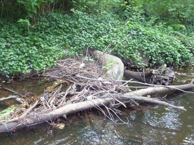
ACTS AS BEER CATCHER.
IVY.
TOILET
BEAVER GUARDS IN PLACE |
|
 |
ID
925 |
Feature #
22 |
From Last
11.9 |
Type
Modification-Rip-rap |
Size
6.6 M |
Bank
Both |
Adjacent Land Use
Parks |
Description:
|
Action Items:
|
|
 |
ID
926 |
Feature #
23 |
From Last
7 |
Type
Modification-Culvert |
Size
0.6 WIDE AND HIGH |
Bank
Right |
Adjacent Land Use
Parks |
Description:
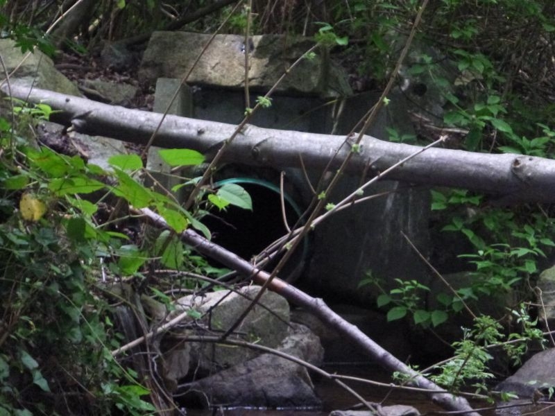
OUTFALL.CONCRETE APRON IS 0.90 LEFT 0.90 ACROSS THE BACK AND 0.90 RIGHT |
Action Items:
CONCRETE FRAME - PLASTIC PIPE IS REPLACEMENT. |
|
 |
ID
927 |
Feature #
24 |
From Last
0.05 |
Type
Enhancement-Riparian Planting, Woody debris Placement, Spawning Gravel Placement |
Size
W=7.6 L 6.4 |
Bank
Both |
Adjacent Land Use
Commercial |
Description:
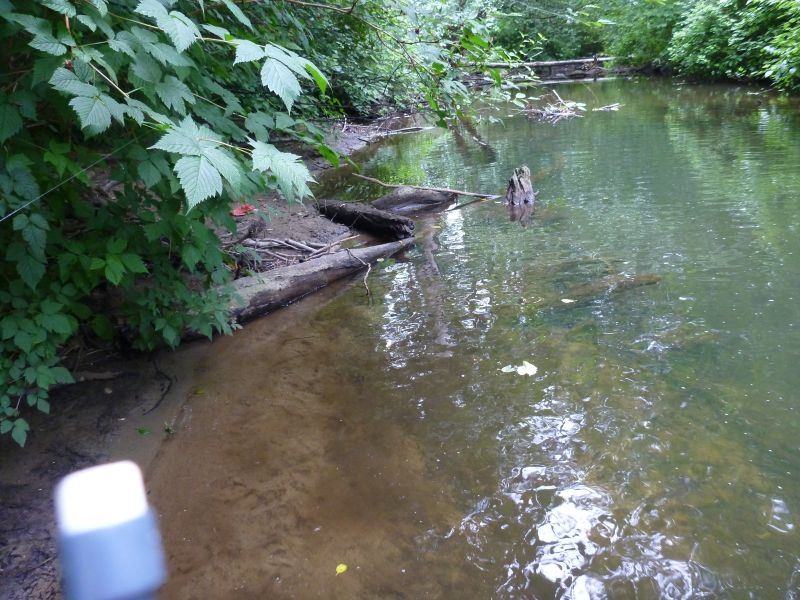
RIFFLE |
Action Items:
|
|
 |
ID
928 |
Feature #
25 |
From Last
26 |
Type
Enhancement-Riparian Planting, Woody debris Placement, Spawning Gravel Placement |
Size
W=1.5 L 2.4 |
Bank
Left |
Adjacent Land Use
Parks |
Description:
|
Action Items:
GETTING A LITTLE BURIED.KEEP AN EYE ON THIS AREA - REEVALUATE FUNCTION |
|
 |
ID
929 |
Feature #
26 |
From Last
1 M |
Type
Bank Erosion |
Size
|
Bank
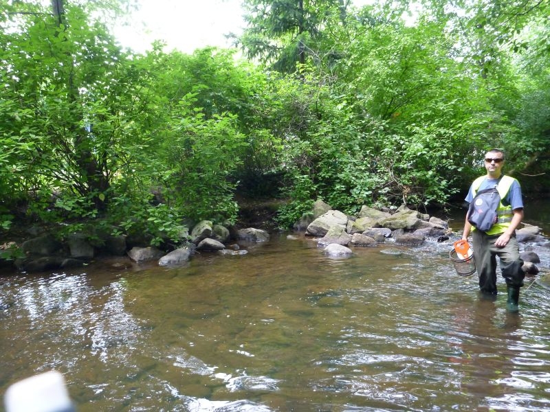
Right |
Adjacent Land Use
Parks |
Description:
|
Action Items:
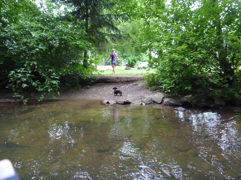
OPENING FOR DOG SWIMMING AS THERE IS A POOL HERE. No fish in this whole enhanaced area so until fish return might be a good pot for Spot |
|
 |
ID
930 |
Feature #
27 |
From Last
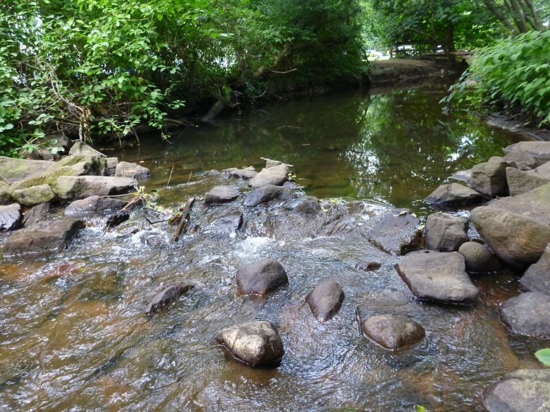
5 |
Type
Modification-Rip-rap |
Size
9m in L |
Bank
Right |
Adjacent Land Use
Parks |
Description:
|
Action Items:
|
|
 |
ID
931 |
Feature #
28 |
From Last
5.8 |
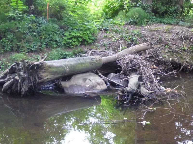
Type
Enhancement-Log/Rock weir, Fishway |
Size
W=7.1 L=2.3 |
Bank
Both |
Adjacent Land Use
Parks |
Description:
RIFFLE |
Action Items:
|
|
 |
ID
932 |
Feature #
29 |
From Last
19.4 |
Type
LACK OF RIPARIAN VEGETATION |
Size
15.8 LONG |
Bank
Right |
Adjacent Land Use
Parks |
Description:
|
Action Items:
same pic as enahancement |
|
 |
ID
933 |
Feature #
30 |
From Last
23.5 |
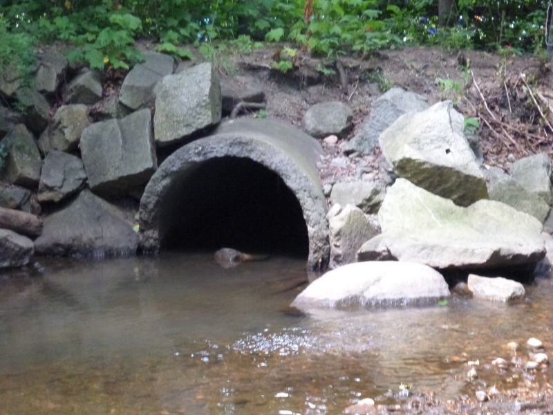
Type
Enhancement-Riparian Planting, Woody debris Placement, Spawning Gravel Placement |
Size
W=2.3 L=3.75 |
Bank
Right |
Adjacent Land Use
Parks |
Description:
even with enhancement this is just one long muddy glide |
Action Items:
even with enhancement this is just one long muddy glide
review for function |
|
 |
ID
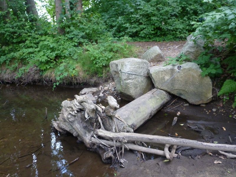
934 |
Feature #
31 |
From Last
19.2 |
Type
Modification-Culvert |
Size
opening is 1.4m |
Bank
Right |
Adjacent Land Use
Parks |
Description:
outfall is concrete
RIP RAP L 6.3 |
Action Items:
|
|
 |
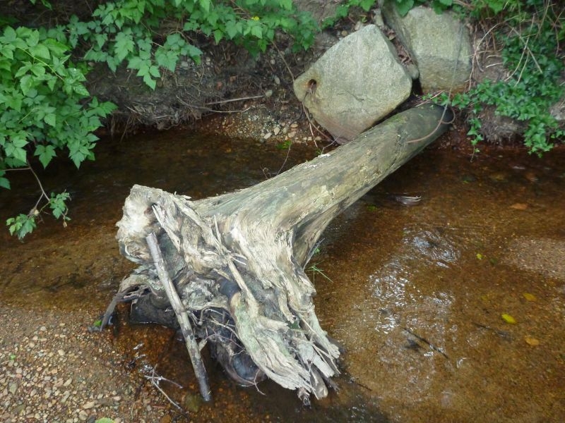
ID
935 |
Feature #
32 |
From Last
1.2 |
Type
Enhancement-Riparian Planting, Woody debris Placement, Spawning Gravel Placement |
Size
3.2 in L 3.6 in width |
Bank
Left |
Adjacent Land Use
Parks |
Description:
water is 0.30 deep |
Action Items:
|
|
 |
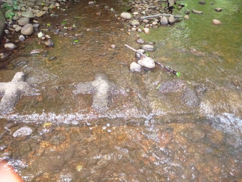
ID
936 |
Feature #
33 |
From Last
13.7 |
Type
Enhancement-Riparian Planting, Woody debris Placement, Spawning Gravel Placement |
Size
W= 2.5 L= 1.1 |
Bank
Left |
Adjacent Land Use
Parks |
Description:
log and rock |
Action Items:
fry spotted here |
|
 |
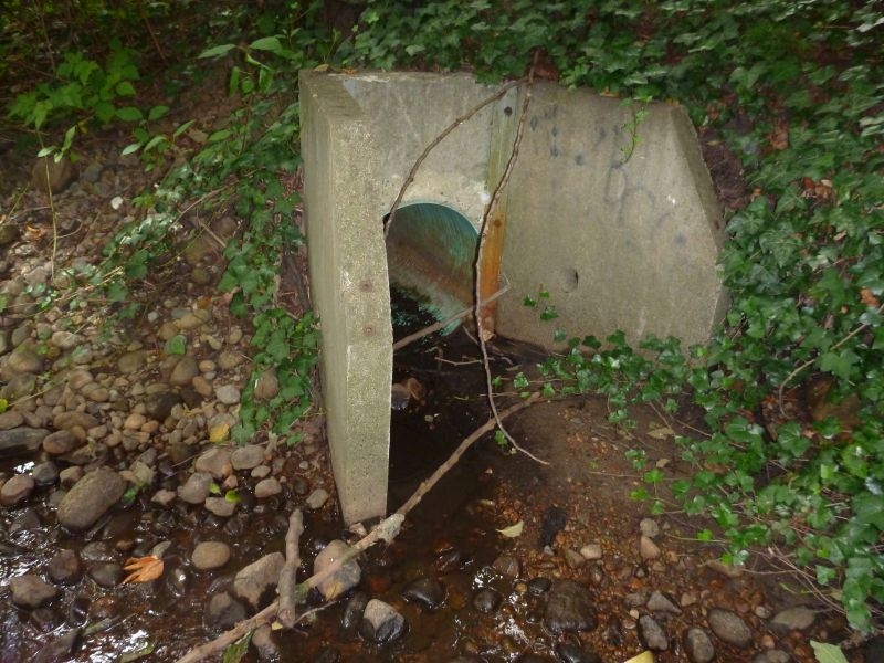
ID
937 |
Feature #
34 |
From Last
6.3 |
Type
Enhancement-Log/Rock weir, Fishway |
Size
W=4.7 L=0.6 |
Bank
Both |
Adjacent Land Use
Parks |
Description:
CEMENT WEIR. |
Action Items:
|
|
 |
ID
938 |
Feature #
35 |
From Last
3.4 |
Type
Modification-Culvert |
Size
0.75 pipe opening |
Bank
Right |
Adjacent Land Use
Parks |
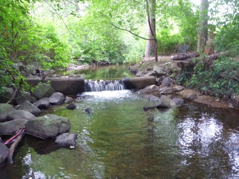
Description:
concrete apron 0.90 L 0.75 top 0.90 left |
Action Items:
POINTED U/S Odd placement
SOMETHING HISSED FROM INSIDE. |
|
 |
ID
939 |
Feature #
36 |
From Last
6.7 |
Type
Modification-Other |
Size
W=5.7 L=0.73 |
Bank
Left |
Adjacent Land Use
Parks |
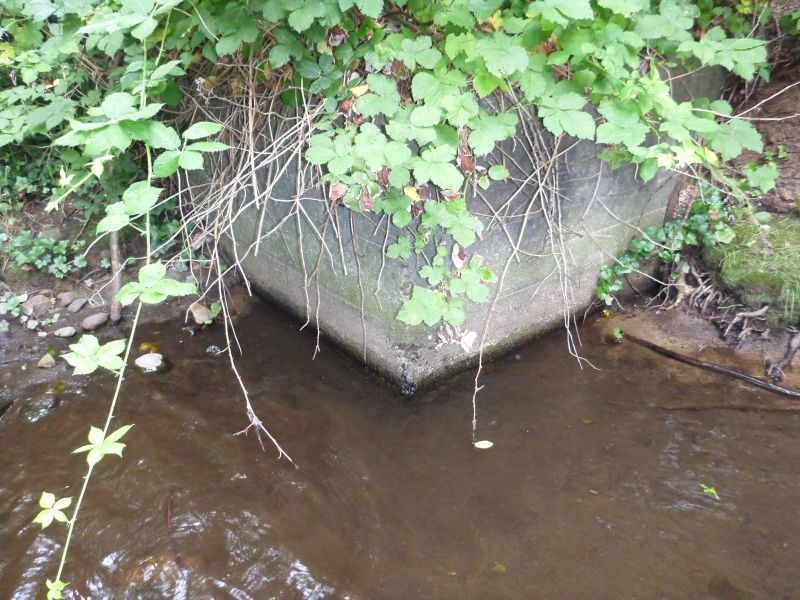
Description:
CEMENT WEIR
SUBSTRATE TO WATER, 0.91
H2O DEPTH 0.54 |
Action Items:
LOOKS LIKE IT'S FALLING FORWARD ON LEFT BANK.
fry in the area |
|
 |
ID
940 |
Feature #
37 |
From Last
8.4 |
Type
Modification-Other |
Size
2.8 |
Bank
Left |
Adjacent Land Use
Parks |
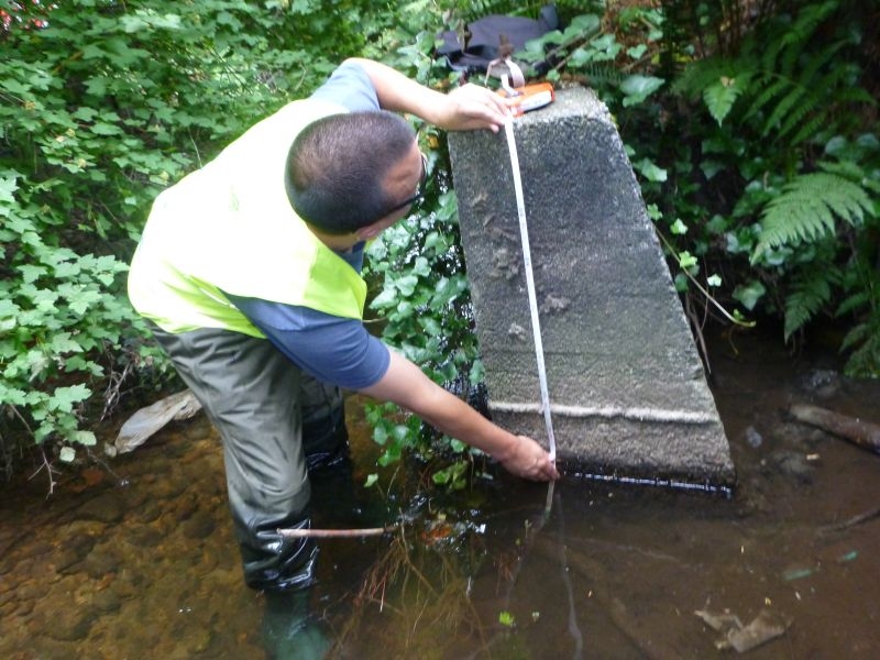
Description:
OLD CONCRETE FOOTING. |
Action Items:
|
|
 |
ID
941 |
Feature #
38 |
From Last
11.9 |
Type
Modification-Other |
Size
L=13.8 H=1.1 |
Bank
Both |
Adjacent Land Use
Parks |
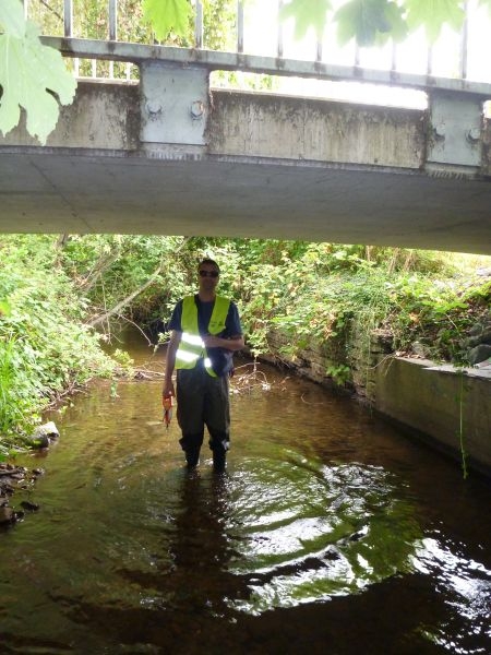
Description:
CONCRETE WALLS. |
Action Items:
CRACKED AT 6.5m ON RIGHT BANK. |
|
 |
ID
942 |
Feature #
39 |
From Last
10.6 |
Type
Modification-Bridge |
Size
W=5.2 L=3.4 |
Bank
Both |
Adjacent Land Use
Commercial |
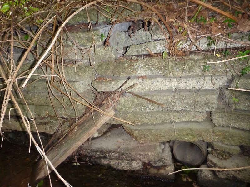
Description:
SUBSTRATE TO BRIDGE BOTTOM, 1.8M |
Action Items:
PARKS/COMMERCIAL.SOMEONE LIVING UNDER BRIDGE.
FRY. |
|
 |
ID
943 |
Feature #
40 |
From Last
3.0 |
Type
Modification-Other |
Size
34.7 long |
Bank
Left |
Adjacent Land Use
Undisturbed |
Description:
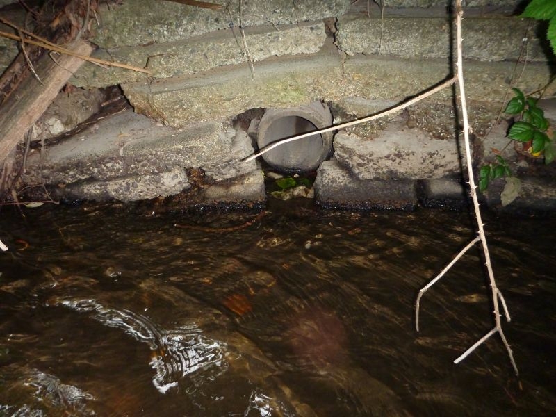
NEW WALL. |
Action Items:
WALL AT 10.5 IS NOT HELD TOGETHER.SEE PIC |
|
 |
ID
944 |
Feature #
41 |
From Last
10.5 |
Type
Modification-Culvert |
Size
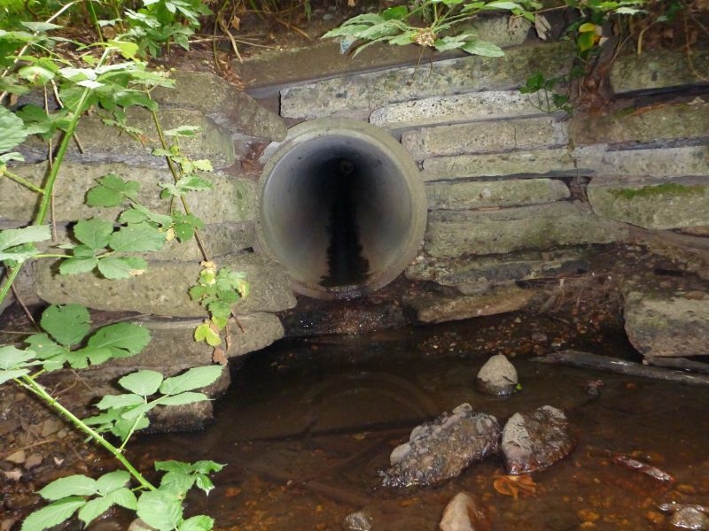
0.3 across and high |
Bank
Left |
Adjacent Land Use
Undisturbed |
Description:
PIPE AT BASE OF WALL. |
Action Items:
DRY today |
|
 |
ID
945 |
Feature #
42 |
From Last
17.4 |
Type
Modification-Culvert |
Size
0.70 |
Bank
Left |
Adjacent Land Use
Commercial |
Description:
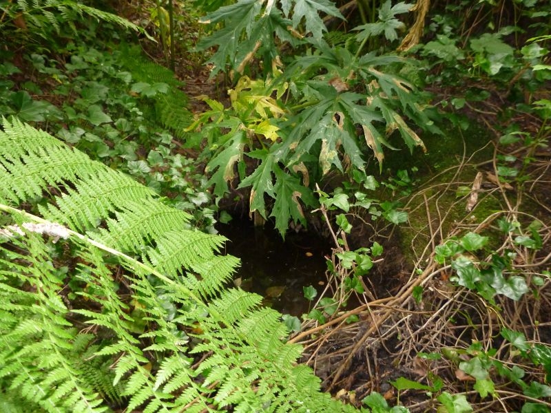
OUTFALL. |
Action Items:
DISCHARGING STINKS.Take further water quality sample here (UBC waterlogged) |
|
 |
ID
946 |
Feature #
43 |
From Last
33.5 |
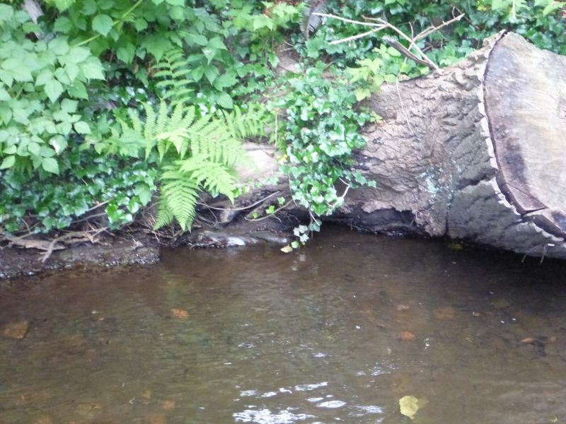
Type
Modification-Culvert |
Size
0.20 |
Bank
Right |
Adjacent Land Use
Commercial |
Description:
OUTFALL PIPE.PIPE IS BEHIND THE HOG WEED. |
Action Items:
DISCHARGE GOES INTO DUG OUT POOL. |
|
 |
ID
947 |
Feature #
44 |
From Last
20.3 |
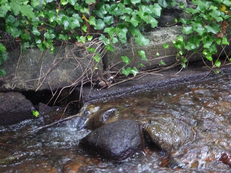
Type
Modification-Rip-rap |
Size
4.o m |
Bank
Left |
Adjacent Land Use
Commercial |
Description:
|
Action Items:
|
|
 |
ID
948 |
Feature #
45 |
From Last
13.5 |
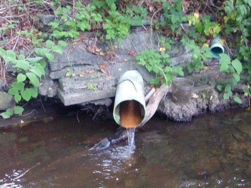
Type
Modification-Other |
Size
H=0.24 L=18.5 |
Bank
Right |
Adjacent Land Use
Undisturbed |
Description:
RETAINING WALL. |
Action Items:
hobo in area - smells like sewage here (at 14.3 m upstream) |
|
 |
ID
949 |
Feature #
46 |
From Last
40.0m |
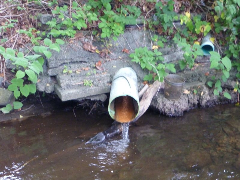
Type
Modification-Other |
Size
H=0.25 L=.10 |
Bank
Right |
Adjacent Land Use
Commercial |
Description:
RETAINING WALL. |
Action Items:
|
|
 |
ID
950 |
Feature #
47 |
From Last
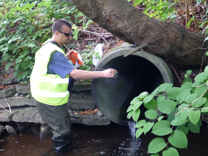
20.4 |
Type
Modification-Culvert |
Size
0.40 |
Bank
Right |
Adjacent Land Use
Commercial |
Description:
|
Action Items:
flowing |
|
 |
ID
951 |
Feature #
48 |
From Last
0.7 |
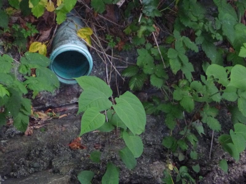
Type
Modification-Culvert |
Size
0.80 |
Bank
Left |
Adjacent Land Use
Commercial |
Description:
|
Action Items:
|
|
 |
ID
952 |
Feature #
49 |
From Last
1.2 |
Type
Modification-Culvert |
Size
0.25 |
Bank
Right |
Adjacent Land Use
Commercial |
Description:
|
Action Items:
NOT DISCHARGING |
|
 |
ID
953 |
Feature #
50 |
From Last
3.3 |
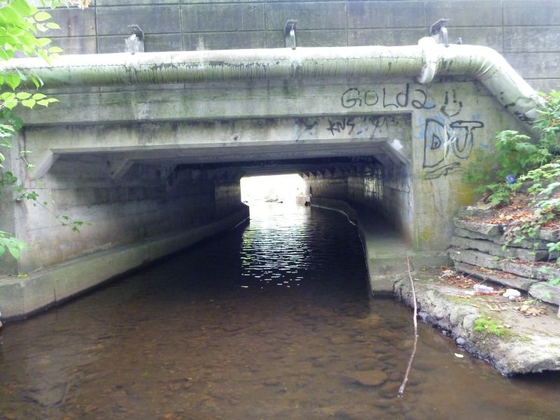
Type
Modification-Bridge |
Size
W=3.6 L=22.6 |
Bank
Both |
Adjacent Land Use
Commercial |
Description:
SUBSTRATE TO BOTTOM 2.1
H2O DEPTH 0.27 |
Action Items:
MARINE DRIVE. |
|
 |
ID
954 |
Feature #
51 |
From Last
4.3 |
Type
Modification-Other |
Size
|
Bank
Both |
Adjacent Land Use
Commercial |
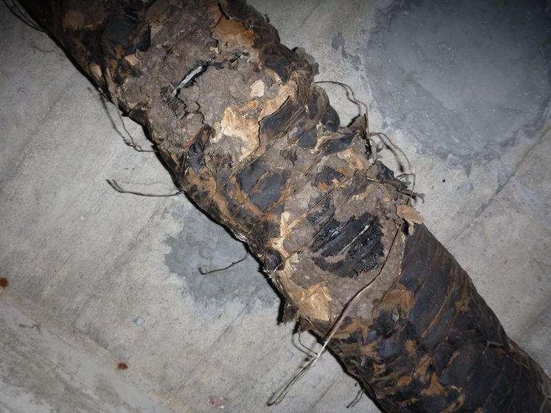
Description:
OVERHEAD PIPE, WRAP ROTTING. |
Action Items:
take a look at this overhead |
|
 |
ID
955 |
Feature #
52 |
From Last
15.4 |
Type
Modification-Culvert |
Size
0.50 |
Bank
Left |
Adjacent Land Use
Residential |
Description:
ANOTHER OVERHEAD PIPE here as well |
Action Items:
STARTED HEAVY DISCHARGE AS WE GOT THERE. ORANGE STAIN, FLOW ENDED AFTER 2 MIN. |
|
 |
ID
956 |
Feature #
53 |
From Last
3.0 |
Type
Modification-Other |
Size
42.6 L |
Bank
Both |
Adjacent Land Use
Residential |
Description:
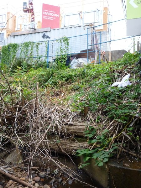
DEVELOPMENT SITE. LOG CRIBBING.
photo is from left bank |
Action Items:
RESIDENTIAL/PARKS
KEROSATE LOGS.
knotweed in area |
|
 |
ID
957 |
Feature #
54 |
From Last
29.4 |
Type
Modification-Other |
Size
|
Bank
Right |
Adjacent Land Use
Residential |
Description:
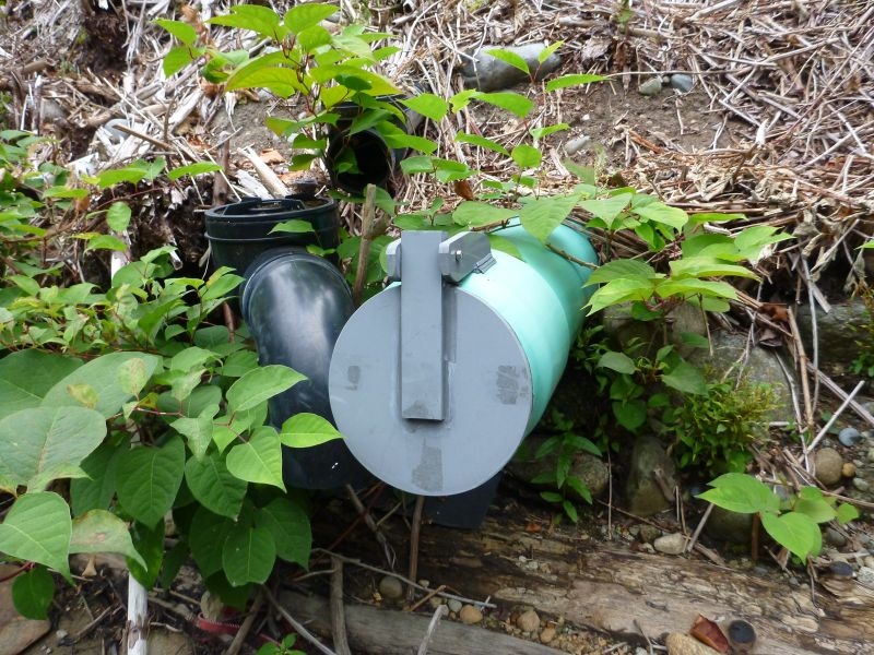
FLAPPED PIPE. |
Action Items:
RESIDENTIAL/PARKS
UNSURE OF PURPOSE. OPENED IT AND FOUND SILTY BOTTOM |
|
 |
ID
958 |
Feature #
55 |
From Last
13 |
Type
Modification-Bridge |
Size
W= 10.3 L=7 |
Bank
Both |
Adjacent Land Use
Residential |
Description:
|
Action Items:
NO CAREFREE CREEK DURING BUILDING OF THIS APARTMENT BUILDING.
Hoses are overflowing from development site, water is running over the site and into th |
|
 |
ID
959 |
Feature #
56 |
From Last
5.6 |
Type
Modification-Other |
Size
0.10 |
Bank
Right |
Adjacent Land Use
Residential |
Description:
|
Action Items:
not discharging at the moment the riparian plants that were planted here are dead
FRY |
|
 |
ID
960 |
Feature #
57 |
From Last
1.1 |
Type
Modification-Culvert |
Size
0.10 |
Bank
Right |
Adjacent Land Use
Parks |
Description:
steel |
Action Items:
old metal pipe |
|
 |
ID
961 |
Feature #
58 |
From Last
26.8 |
Type
Modification-Rip-rap |
Size
16.6 = L |
Bank
Left |
Adjacent Land Use
Parks |
Description:
|
Action Items:
OLD METAL PIECE. |
|
 |
ID
962 |
Feature #
59 |
From Last
29.8 |
Type
LACK OF RIPARIAN VEGETATION |
Size
11.2 m in lenght |
Bank
Right |
Adjacent Land Use
Parks |
Description:
|
Action Items:
This is a kids play area so not for planting
saw lots of fry here |
|
 |
ID
963 |
Feature #
60 |
From Last
27.3 |
Type
Bank Erosion |
Size
L - 2.45 W =12.3 sub to bottom is 1.6 |
Bank
Both |
Adjacent Land Use
Parks |
Description:
|
Action Items:
cardboard under this bridge on left bank |
|
 |
ID
964 |
Feature #
61 |
From Last
11.5 |
Type
Modification-Culvert |
Size
W=12.3 L=2.45 |
Bank
Right |
Adjacent Land Use
Parks |
Description:
pipe |
Action Items:
hatchery pipe? |
|
 |
ID
965 |
Feature #
62 |
From Last
2.9 |
Type
Modification-Other |
Size
|
Bank
Right |
Adjacent Land Use
Parks |
Description:
cluster of pipes
ranging from 12 to 15 cm |
Action Items:
HATCHERY PIPES |
|
 |
ID
966 |
Feature #
63 |
From Last
8.8 |
Type
Modification-Rip-rap |
Size
40 m in L |
Bank
Right |
Adjacent Land Use
Parks |
Description:
|
Action Items:
red algae and heron in the area |
|
 |
ID
967 |
Feature #
64 |
From Last
54.7 |
Type
LACK OF RIPARIAN VEGETATION |
Size
4.1m |
Bank
Left |
Adjacent Land Use
Parks |
Description:
|
Action Items:
Dog area. might be a good spot to formalize for this as in the back end of park |
|
 |
ID
968 |
Feature #
65 |
From Last
24.5.m |
Type
Modification-Culvert |
Size
0.40 |
Bank
Right |
Adjacent Land Use
Parks |
Description:
|
Action Items:
49"19'31
123"5'60 |
|
 |
ID
969 |
Feature #
66 |
From Last
10.2 |
Type
Modification-Bridge |
Size
L=2.45 W = 12.50 |
Bank
Both |
Adjacent Land Use
Parks |
Description:
footbridge
sub to bottom of bridge 1.5m |
Action Items:
|
|
 |
ID
970 |
Feature #
67 |
From Last
3.0 |
Type
LACK OF RIPARIAN VEGETATION |
Size
31m |
Bank
Left |
Adjacent Land Use
Parks |
Description:
|
Action Items:
Plant to provide shade |
|
 |
ID
971 |
Feature #
|
From Last
|
Type
LACK OF RIPARIAN VEGETATION |
Size
|
Bank
Mid-stream |
Adjacent Land Use
Parks |
Description:
|
Action Items:
|
|