 |
ID
1097 |
Feature #
1 |
From Last
0 |
Type
Modification-Culvert |
Size
32.8 m length, 4.2 m diameter, 1.7 m height to sub |
Bank
Both |
Adjacent Land Use
Residential |
Description:
large diameter and length culvert running under Cedar Valley Connector. |
Action Items:
None. Large enough to avoid upstream pooling. |
|
 |
ID
1098 |
Feature #
2 |
From Last
|
Type
Modification-Rip-rap |
Size
40 m length, 0.8 m height |
Bank
Right |
Adjacent Land Use
Residential |
Description:
Boulders along RB, but not recently installed. Crumbling into channel. |
Action Items:
No longer functioning to prevent erosion on bank. |
|
 |
ID
1099 |
Feature #
3 |
From Last
|
Type
Bank Erosion |
Size
5 m length, 1.5 m height |
Bank
Left |
Adjacent Land Use
Undisturbed |
Description:
Cobble and boulders falling from bank into stream, soil banks eroding into stream. |
Action Items:
Invasives growing along bank, potential for bank restabilization/revegetation |
|
 |
ID
1100 |
Feature #
4 |
From Last
|
Type
WATERBODY-Tributary, wetland, ditch, other |
Size
1.7 m bankfull width, 1.3 m wetted width, average |
Bank
Right |
Adjacent Land Use
Residential |
Description:
8 degrees about 10 m upstream of confluence, vs 7 degree in mainstem. Flows from west through low gradient bench. Measures: 1.7 m bankful width, 1.3 m |
Action Items:
Potential for off-channel habitat. Possible source of silt into mainstem. |
|
 |
ID
1101 |
Feature #
5 |
From Last
|
Type
LACK OF RIPARIAN VEGETATION |
Size
30 m length x 5 m width on both banks |
Bank
Both |
Adjacent Land Use
Residential |
Description:
Both banks are level and may have been cleared historically. There is minimal vegetation and surprisingly not covered in blackberry or other invasives |
Action Items:
Banks are unstable and subject to erosion. Lack of riparian and easy creek access encourages human usage. |
|
 |
ID
1102 |
Feature #
6 |
From Last
|
Type
Bank Erosion |
Size
30 m length |
Bank
Left |
Adjacent Land Use
Undisturbed |
Description:
Clay bank along the right bank/outside of stream bend. This is where a pair of chum were observed spawning Nov 1. Notice the sand/gravel deposition on |
Action Items:
Stream bank stabilization/revegetation. Contributes to siltation downstream |
|
 |
ID
1103 |
Feature #
7 |
From Last
|
Type
Bank Erosion |
Size
25 m length x 2 m height |
Bank
Right |
Adjacent Land Use
Residential |
Description:
Erosion on RB, clay patches present. |
Action Items:
Active bank erosion and sediment loading into stream. |
|
 |
ID
1104 |
Feature #
8 |
From Last
|
Type
Obstruction-Log Jam |
Size
|
Bank
Across |
Adjacent Land Use
Undisturbed |
Description:
3 large logs suspended over, but above stream. Potential for debris accumulation. |
Action Items:
Nothing, watch for LWD build-up from branches and twigs caught during high water. |
|
 |
ID
1105 |
Feature #
9 |
From Last
|
Type
GARBAGE |
Size
|
Bank
Left |
Adjacent Land Use
Residential |
Description:
Site of homeless camp on LB. Flat bench. Also possibly people dumping garbage over fence from Cedar Valley Connector sidewalk. |
Action Items:
Contact District of Mission for clean-up. Potential for hazardous materials. Garbage caught up in the stream. |
|
 |
ID
1106 |
Feature #
10 |
From Last
|
Type
Bank Erosion |
Size
|
Bank
Across |
Adjacent Land Use
Undisturbed |
Description:
RB erosion and sloughing. Located opposite of Feature 9 (garbage at homeless campout). Disturbance indicators: widened channel, sand/gravel deposition |
Action Items:
Erosion and sediment loading. |
|
 |
ID
1107 |
Feature #
11 |
From Last
0 |
Type
Bank Erosion |
Size
30 m long x 3 m wide |
Bank
Mid-stream |
Adjacent Land Use
Residential |
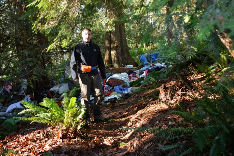
Description:
sand/gravel deposition mid-channel in low gradient section adjacent to homeless camp (feat. 9) Large blue tarp partially buried. |
Action Items:
Clean out garbage instream from homeless camp. |
|
 |
ID
1108 |
Feature #
12 |
From Last
|
Type
GARBAGE |
Size
|
Bank
Right |
Adjacent Land Use
Residential |
Description:
Large dumping of mainly clothing on right bank. Follow trail from creek up the bank to clearing. |
Action Items:
Contact city to clean up. |
|
 |
ID
1109 |
Feature #
13 |
From Last
|
Type
Obstruction-Log Jam |
Size
8.6 m length, 1.2 m height, 1.9 m width |
Bank
Left |
Adjacent Land Use
Residential |
Description:
Partially obstructing the channel on left bank, where SWD has become trapped around LWD. |
Action Items:
Clear debris as needed (if channel is blocked) |
|
 |
ID
1110 |
Feature #
14 |
From Last
|
Type
Obstruction-Log Jam |
Size
7.5 m length; 0.9 m height; 1.6 m width |
Bank
Across |
Adjacent Land Use
Undisturbed |
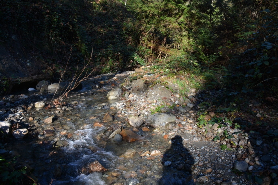
Description:
Partially blocking channel on left side with trapped SWD. We removed the LWD piece from the stream (visible on the bottom left of photo.) |
Action Items:
Remove LWD, SWD that builds up as needed to keep channel clear |
|
 |
ID
1111 |
Feature #
15 |
From Last
|
Type
Bank Erosion |
Size
3.2 m height |
Bank
Right |
Adjacent Land Use
Residential |
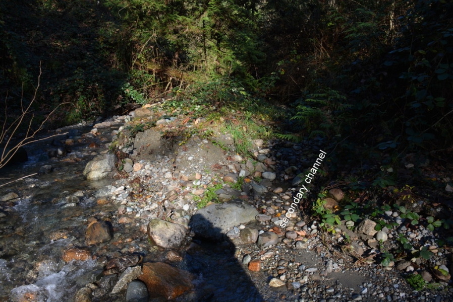
Description:
Erosion on right bank, visible in upper left corner of photo. Vertical bank approx 3.2 m high, |
Action Items:
Source of sediments instream |
|
 |
ID
1112 |
Feature #
16 |
From Last
0 |
Type
SIDE CHANNEL |
Size
|
Bank
Across |
Adjacent Land Use
Residential |
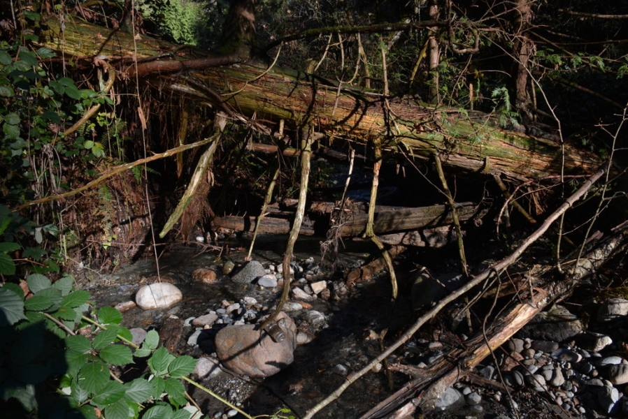
Description:
Secondary channel around mid-channel bar. But bar isn't depositional, it's original left bank that was split by the secondary channel. Small flow thro |
Action Items:
Possible off-channel habitat |
|
 |
ID
1113 |
Feature #
17 |
From Last
|
Type
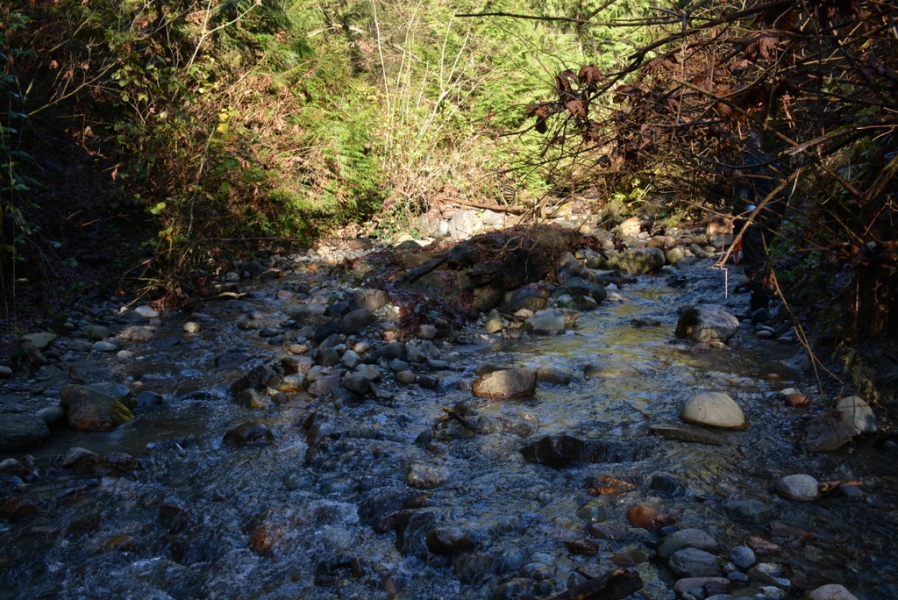
Obstruction-Log Jam |
Size
|
Bank
Across |
Adjacent Land Use
Residential |
Description:
3 logs, 2 partially submerged. Potential for blockage. |
Action Items:
Remove any blockages that occur. |
|
 |
ID
1114 |
Feature #
18 |
From Last
|
Type
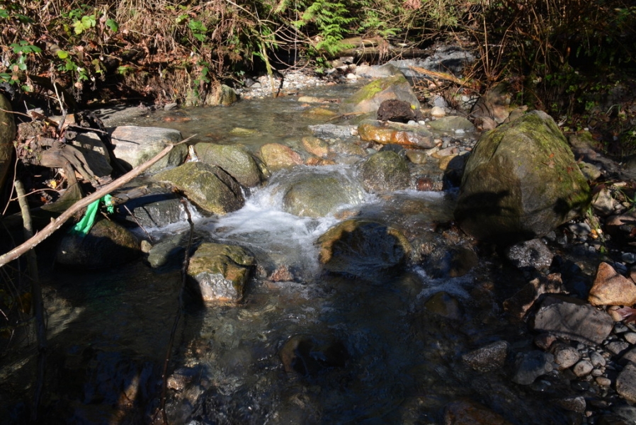
Bank Erosion |
Size
|
Bank
Both |
Adjacent Land Use
Residential |
Description:
Erosion and mid-channel cobble/gravel deposition zone |
Action Items:
Source of erosion, blackberry. |
|
 |
ID
1115 |
Feature #
19 |
From Last
|
Type
Obstruction-Falls, Cascade, Canyon |
Size
3.8 m length; 2.4 m width; 0.4 m vertical (10.5% s |
Bank
Across |
Adjacent Land Use
Residential |
Description:
boulder cascade, good scour pool below (25 cm depth at base) |
Action Items:
fish can pass at high flows. Observed a chum swim up the cascade. |
|
 |
ID
1116 |
Feature #
20 |
From Last
|
Type
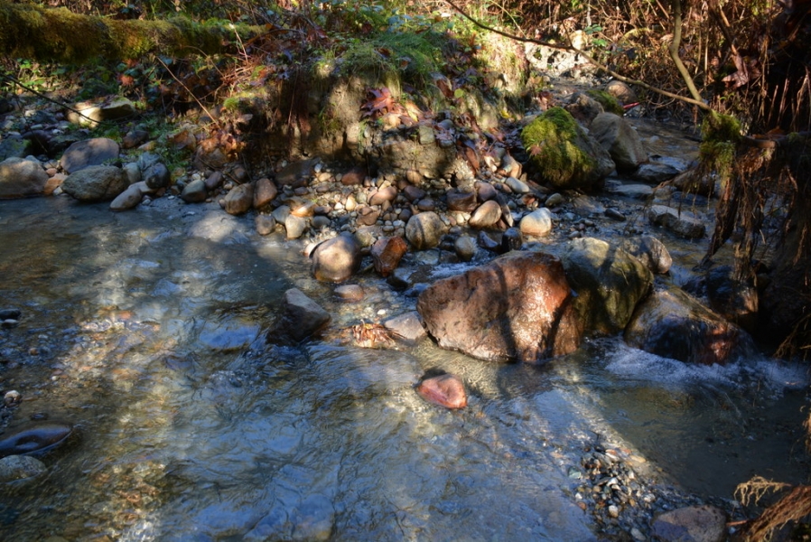
Obstruction-Falls, Cascade, Canyon |
Size
7.9 m length, 0.5 m width, 1 m vertical (6.3% slop |
Bank
Across |
Adjacent Land Use
Residential |
Description:
Narrow passage through clay cascade. Probably impassable for chum, possibly coho. |
Action Items:
possible barrier for migrating salmon |
|
 |
ID
1117 |
Feature #
21 |
From Last
|
Type
WATERBODY-Tributary, wetland, ditch, other |
Size
|
Bank
Both |
Adjacent Land Use
Residential |
Description:
Stream forks into 2 before reaching 7th Ave. End of survey on Nov 19, 2015 |
Action Items:
High steep exposed banks with large areas of slumping visible on both forks. |
|